
Spatial Humanities Public Lecture - "Data, the Campus, and the City: Diachronic Mapping and Houston" by Farès el-Dahdah
Tuesday, May 1, 2018
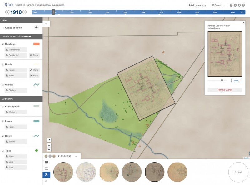
This presentation will introduce “Waterways + Highways: A Diachronic Map of Houston,” one of the nine post-Harvey research projects to receive funding from the Rice Houston Engagement and Recovery Effort (Rice HERE) as well as launch the project “instituteRice: A Diachronic Map of the Rice University Campus.” Both projects consist of online mapping platforms that illustrate the evolution of the city and the campus, respectively, as they existed as well as they have often been imagined. Primary sources, such as photographs, historical maps, surveys, and architectural plans, are located temporally and spatially while their associated visual and geographic data is integrated across a number of databases (including an open-access digital library of images, a geographic information system, an open source relational database, and a content delivery web service). The relationship between the various project elements produce a web environment where qualitative and quantitative data are simultaneously loaded from an API, rendered across platforms, customized in many views, and probed by users in a system that supports multiple and interconnected expressions of diverse data sources.